Next-Gen Search and Rescue:
Direct GPS Tracking via BSS Radio Signaling
Achieve absolute situational awareness in off-grid rescue missions. Our proprietary BSS protocol enables real-time personnel tracking and GPS location reporting directly through your handheld radio fleet.
Why Professionals Choose BSS over APRS?
In emergency response and SAR (Search and Rescue), complexity is the enemy. Traditional APRS systems require TNC hardware and complex SSID configurations. The VGC BSS (Beacon Signaling System) provides a streamlined, professional alternative:
- Zero-Config Tracking: No external modems required.
- Instant ID Reporting: Immediate caller identification.
- High Reliability: Proprietary BSS signaling for better data integrity.
How to Configure GPS Tracking for Your SAR Team
Step 1: Set Your Digital Identity
Access the General Settings > Signaling menu. Assign a unique Local ID to each radio. Enable the "Allow Check" toggle—this is the master switch that allows the Command Center to poll your GPS coordinates.
Step 2: Automate Location Transmission
Within Radio Settings, navigate to PTT Release Signaling. Select "ID + Location". With this active, every time a team member finishes speaking, the radio silently broadcasts their precise GPS location to the hub.
Step 3: Establish the Tactical Map
Align all units to the same frequency. Use the VR-N76 handheld for peer-to-peer directional navigation, or sync with our Android application for a full-scale Tactical Map interface.
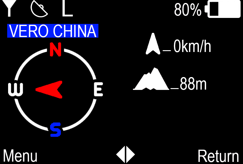
Field Personnel View
The VR-N76 provides a directional compass arrow. When a teammate calls, their distance and heading appear instantly, allowing for zero-visibility navigation.
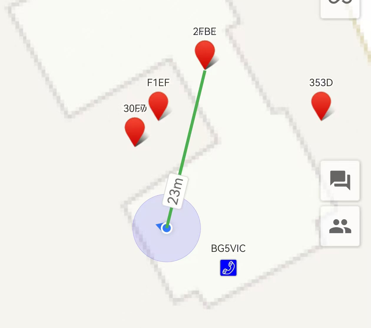
Command Center Interface
The BSS-enabled Android Hub visualizes the entire radio fleet on a topographic map. Monitor Search and Rescue coordination with data on speed, altitude, and distance.